Project Overview
This conceptual proposal inserts a spatial hack into the rigid Cartesian grid of downtown Albuquerque, a nonlinear circuit that weaves above and through infrastructural barriers to reclaim a space for slow, pedestrian interaction. Positioned over Route 25 at the intersection of fragmented neighborhoods and urban voids, the intervention acts as both architectural promenade and data-responsive archive, proposing a new kind of urban interface: one where memory, presence, and passage are made visible.
Conceptual Framework
The design emerged from a desire to recover what is often lost in the urban condition, unplanned social interactions, residual traces of presence, and the layered time scales of daily life. In contrast to the flattened logic of the vehicular grid, this circuit operates at the pace of human movement, creating a space where individuals do not just pass each other, but leave behind spatial imprints, architectural residues of collective presence.
Where sidewalks fail to generate meaningful public interaction, often due to sprawl, scale, or disuse, this structure offers a woven architectural overlay, a new syntax of movement that enables engagement not through direct encounter alone, but through deferred social exchange. Visitors’ movements, gestures, and occupations are cataloged as part of an evolving archive of urban inhabitation.
Design Language and Surface Weaving
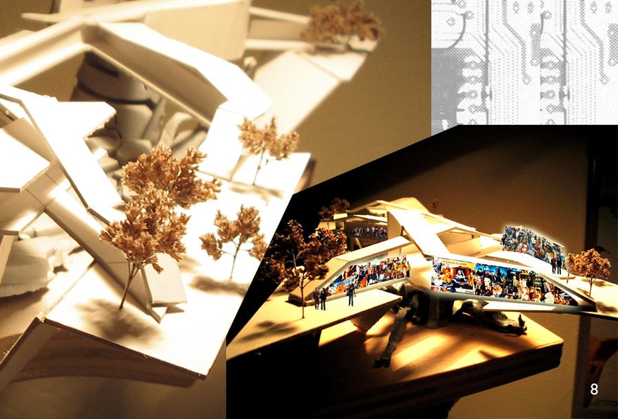
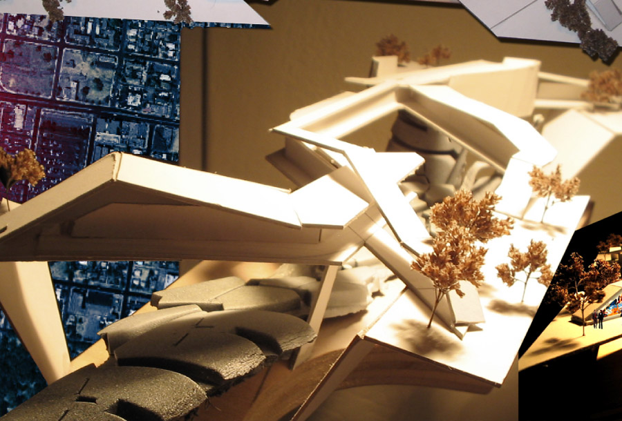
The architectural surfaces are articulated as a continuous weave, planes folding and twisting to form occupiable thresholds, elevated paths, enclosures, and overlooks. This weaving strategy serves not only as a spatial organizer but as a conceptual act: stitching together a broken urban fabric while expressing multiplicity and fluidity over rigidity and control.
The surfaces lift and bifurcate, producing variable conditions of exposure, enclosure, and overlap. These forms create nested zones of rest and gathering along the spine of the intervention, shifting in response to flow patterns, sightlines, and programmatic insertions. Landscape, infrastructure, and architecture are blurred, interacting at seams, nodes, and splits within the continuous form.
Site and Urban Strategy
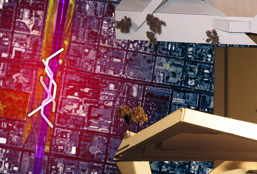
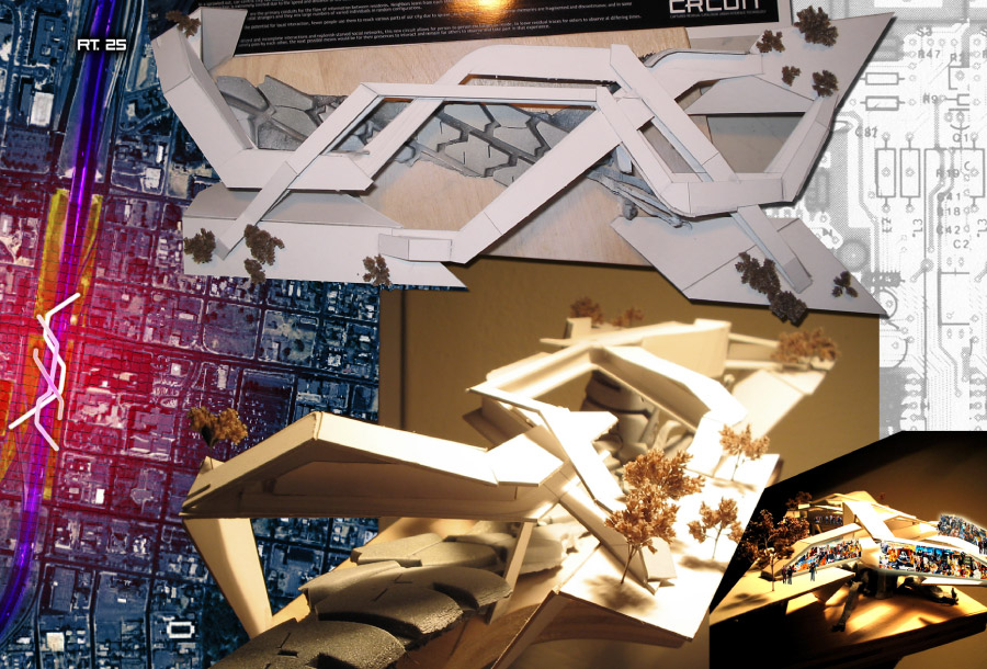
Located at the intersection of downtown, UNM, and the ARTSlab district, the project intervenes in a zone characterized by infrastructural dominance and social disconnection. The circuit burns a path across this condition, elevated above the freeway, suspended over arterial roads, and bridging otherwise disconnected pedestrian environments. It functions not as a destination, but as a tool for re-threading latent public potential into the daily field of the city.
The mapping overlays, referencing circuitry diagrams and heat maps, represent an urban grid reprogrammed for human interaction, not vehicular flow. The intervention establishes a “soft” data network where architectural form becomes an interface for both immediate and residual public activity.
Speculative Technologies
As a research catalyst, the project began a personal trajectory into the intersection of architecture and digital sensing. The idea of collecting ambient social data, through computer vision, motion tracking, or environmental sensing, led to early investigations into projection mapping and responsive façade systems. These technologies were imagined not simply as spectacle, but as architectural media: capable of recording and replaying public memory in real time or asynchronously, allowing ephemeral social interactions to persist in space.
Conclusion
CRCUIT proposes a reprogramming of urban space, not through demolition or replacement, but through spatial overlay and temporal disruption. It challenges the dominance of efficiency and speed in the city’s infrastructure, offering instead a woven surface for public presence, memory, and circulation. Through folded form and digital possibility, the project reclaims a forgotten layer of urban life: one made not of plans and parcels, but of movement, memory, and shared time.


Architecture


Design + Fabrication


Art + Code


