GPS, Geo-tagging, Mapping, Digital Imaging
Project Overview
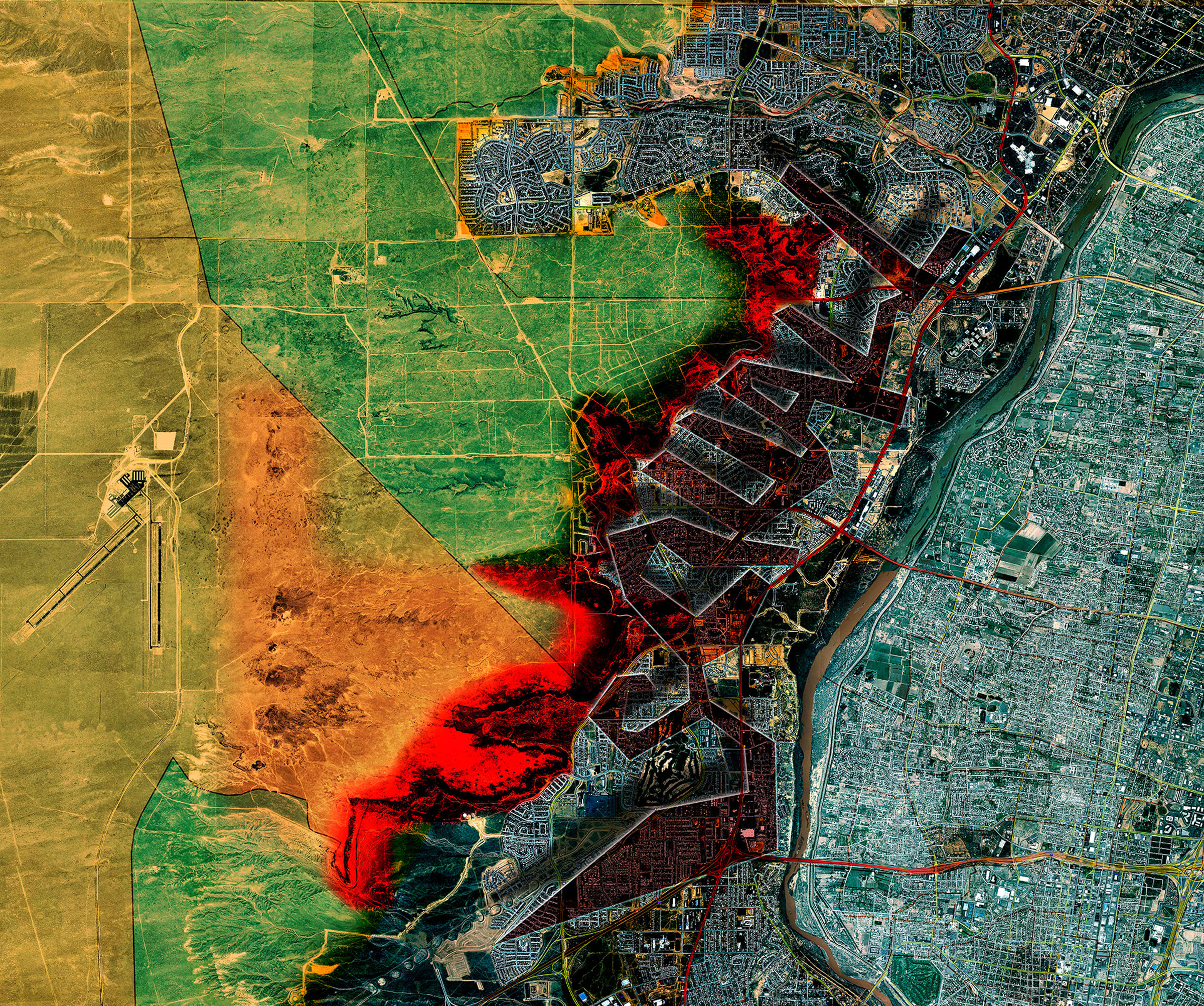
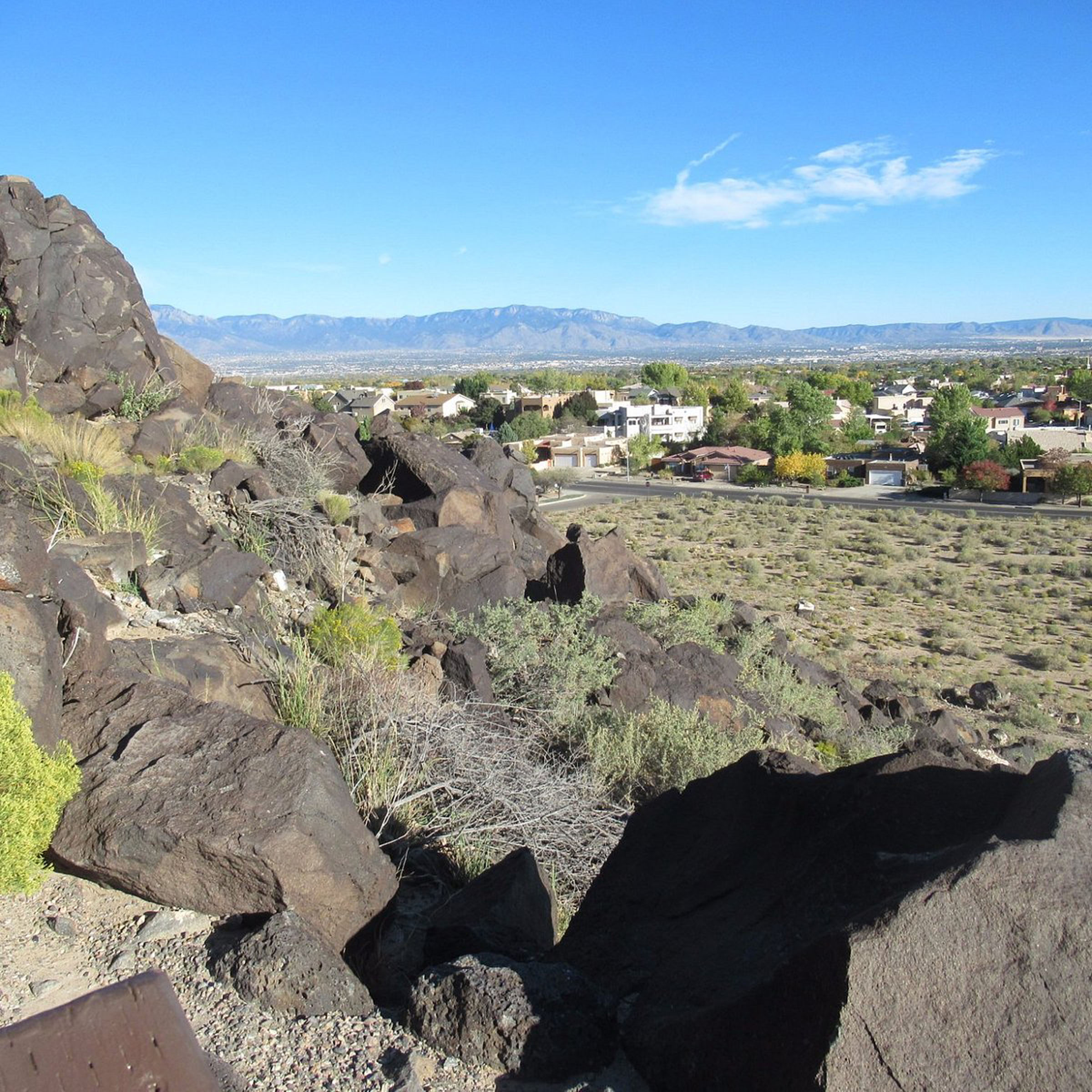
Squall examines the fragile relationship between environment and unchecked suburban sprawl at the edge of Albuquerque, New Mexico. The project stages a confrontation between landscape and development by “writing” onto the land itself — embedding a geo-tagged message across the terrain through a sequence of GPS points. When connected, these coordinates reveal a text-based intervention overlaid onto aerial and satellite imagery, confronting viewers with the storm-like advance of suburban expansion into fragile ecological and cultural territory.
Context and Site
The project is situated at the boundary of Petroglyph National Monument and Petroglyph Estates, a master-planned subdivision emblematic of contemporary sprawl. Petroglyph National Monument protects over 24,000 images carved into volcanic rock, created 400–700 years ago by the ancestors of today’s Pueblo people and later by Spanish settlers. It is among the largest and most significant petroglyph sites in North America. In stark contrast, Petroglyph Estates represents the rapid, homogenized spread of suburban housing, encroaching upon a landscape that holds both cultural and ecological significance.
Methods and Strategy
Using handheld GPS devices, coordinates were systematically dropped across the suburban fringe, within streets, cul-de-sacs, and open spaces surrounding Petroglyph Estates. When plotted and connected, the points form a large-scale word across the landscape, visible in mapping software and satellite imaging. This geo-tagging method transforms suburban space into a charged surface for inscription, mirroring both ancient acts of carving into volcanic stone and contemporary acts of marking through digital coordinates.
Conceptual Framework
The work highlights a clash of temporalities and values: the permanence of petroglyphs etched into stone versus the transience of asphalt, drywall, and speculative development. Just as a sudden squall brings turbulence and change, suburban growth operates as a stormfront sweeping across the desert, consuming open space and eroding cultural memory. By inscribing a message at territorial scale, Squall calls attention to this encroachment while also questioning how technology mediates our understanding of land, boundaries, and heritage.
Impact
Squall is both a critique and a proposal. It critiques the ease with which suburban frameworks overwrite cultural landscapes, reducing them to backdrops for housing tracts. Simultaneously, it proposes a method of resistance: geo-tagging as an act of contemporary inscription that reclaims spatial agency. In doing so, the project transforms mapping into a form of cultural commentary, revealing the storm of sprawl as not only a physical condition but also a narrative inscribed into land and memory.
Conclusion
By overlaying digital coordinates onto terrain marked for centuries by indigenous petroglyphs, Squall underscores the fragility of cultural and ecological landscapes under pressure from suburban expansion. It positions technology as both witness and participant in this conflict, turning data into a form of drawing and mapping into a mode of resistance. The project invites reflection on the cumulative impact of growth and the need for more deliberate, culturally informed approaches to land stewardship.